blah blah blah
Mt. Monadnock via Pumpelly Trail
Length: 8.8 miles out-and-backDifficulty (click for info): Very Hard
Elevation Gain: 1950 feet (-300 feet)
Rating (click for info): 8/10
Elevation: 3159'
Prominence: 2150'
Driving Directions:
Trailhead is on Lake Road in Dublin, NH (summit is in Jaffrey). Lake Road leaves the south side of Rt. 101 2.4 miles west of Rt. 137 and 7.8 miles east of Rt. 124. The trailhead is on the left and is marked. Park only on the left side of the road (signs prohibit parking on the right). The roadside space is very limited and parking will be difficult if there are more than one or two cars already parked.
About the Hike:
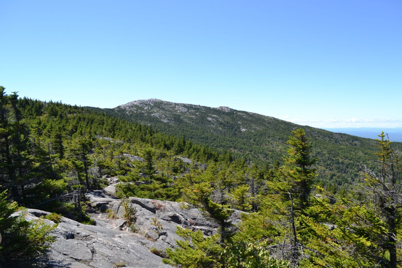
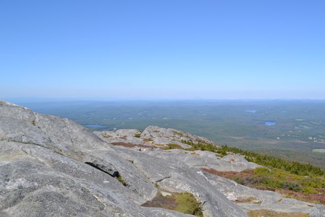
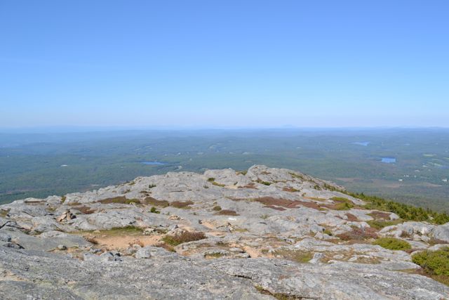
Mt. Monadnock is said to be the third most climbed mountain in the world. It is so famous that a geological term was named after it. A 'monadnock' is defined as "an isolated rock hill, knob, ridge, or small mountain that rises abruptly from a gently sloping or virtually level surrounding plain" (Wikipedia). It attracts tens of thousands of hikers each year, which can make for a crowded hike. The Pumpelly Trail is the longest trail on the mountain, one of the least popular, and one of the most scenic. It ascends the Pumpelly Ridge, the mountain's long northeastern extension. The first half of the hike begins with an easy walk through the forest, while the second half is over open ledges on the ridge. The trail provides constant views, but requires many tedious short descents.
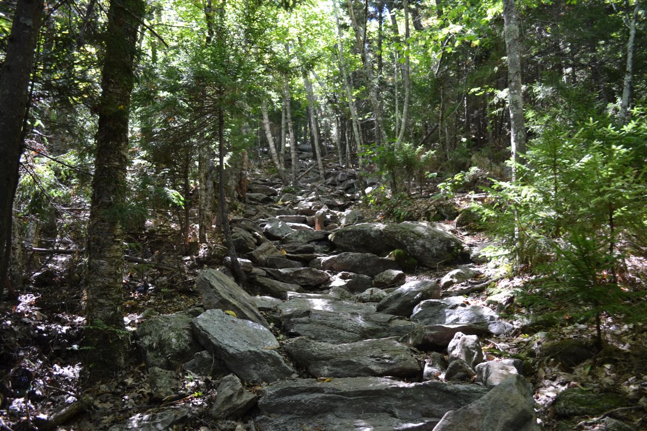
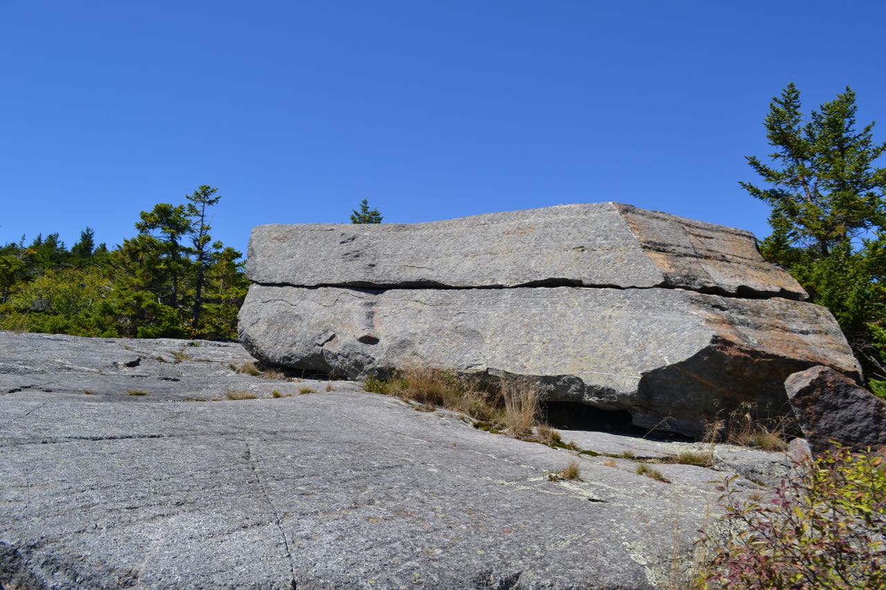
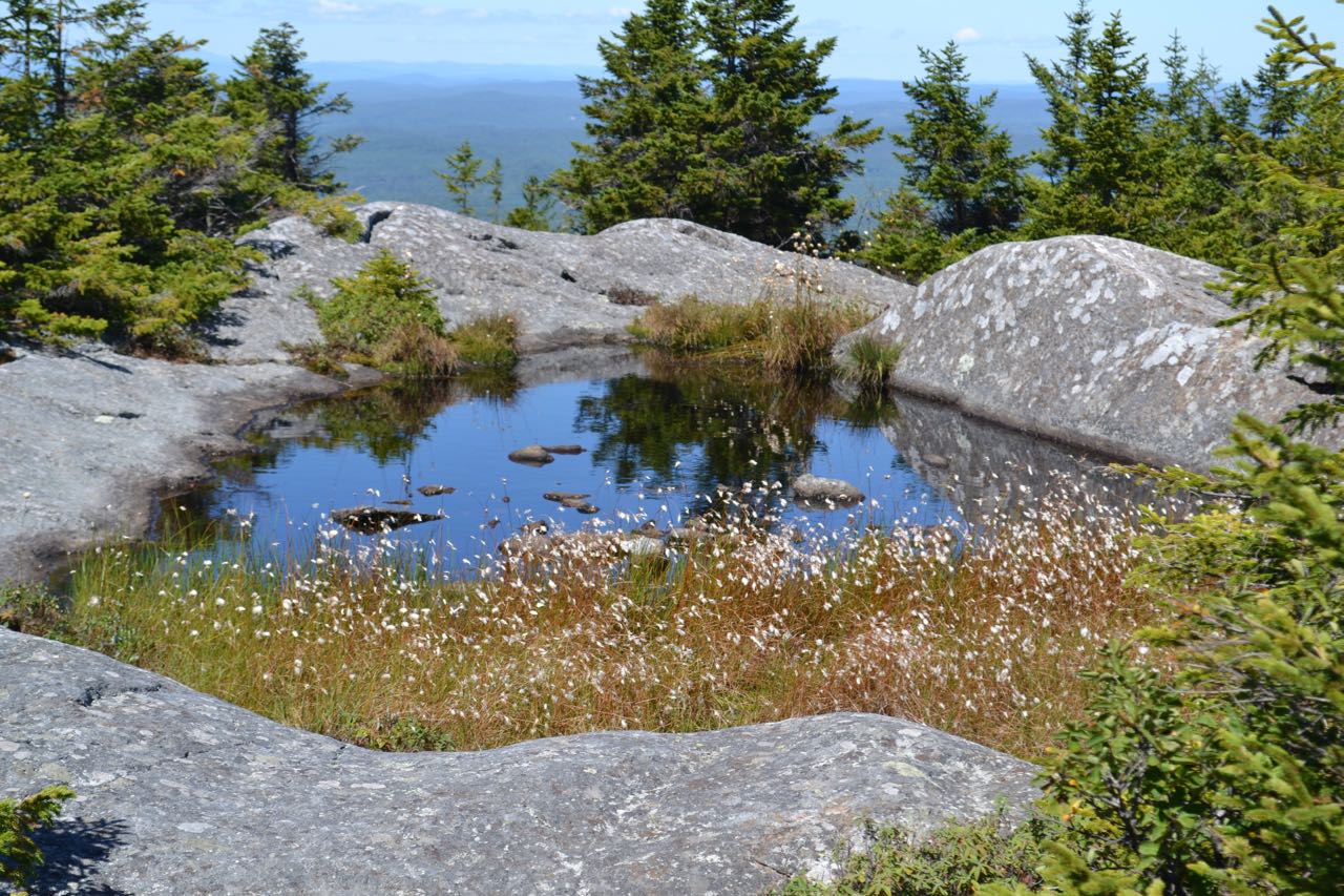
From the trailhead, begin hiking on the Pumpelly Trail. The trail follows a wide path past some signs and through a clearing behind a house, then turns right as the wide path continues ahead. In a short distance, it swings left onto an old road and begins a gradual ascent of Oak Hill. The path soon becomes rocky and passes near the summit of Oak Hill in 0.7 miles. It then descends slightly and continues at easy grades up and down through the pleasant forest for the next mile, until the trail abruptly reaches a stone staircase. It immediately begins a steep, rocky climb. It eventually moderates and reaches open rock in half a mile. Walking is easy over the rock, and there are limited views. After crossing some ledges with good views, it drops back into the forest and ascends over rugged terrain to the next open area, where you can look back down the ridge. The trail continues over intermittent ledges to a trail junction with Cascade Link (bear right), 0.8 miles from the first ledges. Continuing on Pumpelly Trail, it passes through more open ledges with good views west into Vermont and ahead up the ridge to the summit. The trail ascends along the side of the ridge, then swings toward the ridge top and passes the summit of Town Line Peak on the left in another 0.4 miles. Scramble up to the small pinnacle for good views in all directions. The trail descends easily, and in 0.2 miles, passes Spellman Trail on the left in a small col. Just beyond, it passes within sight (through the trees) of a marsh. The trail then climbs to wide open ledges and passes a rectangular rock named "The Sarcophagus", then goes by the first of several alpine bogs. In 0.3 miles from the last junction, pass Red Spot Trail. The trail now dips sharply back into the forest for the last time, then climbs a very steep ledge and ascends completely in the open, following large cairns and passing more alpine bogs. The summit is reached in 0.4 miles. Approaching the summit, cairns (and an obvious route) disappear. Note: to locate the trail when you're ready to leave, look for the "Pumpelly" sign painted on a rock.
The summit presents a unique view of a very flat area, because of Monadnock's isolation. From the east to the southwest, the terrain around you is fairly level for as far as you can see, with the exception of the small Wapack Range and a few isolated hills, such as Gap Mountain and the Uncanoonucs. To the west, you can see the long ridgeline of the Green Mountains in Vermont. Most prominent are Stratton Mountain, to the west-northwest, and Mt. Ascutney, to the north-northwest. To the north are Croydon Peak and several mountains around Pillsbury State Park, including Lovewell Mountain and Mt. Sunapee. On very clear days, you can see the White Mountains stretching from north to northeast. To the northeast are the Ossipee and Belknap Ranges.
Printable directions page